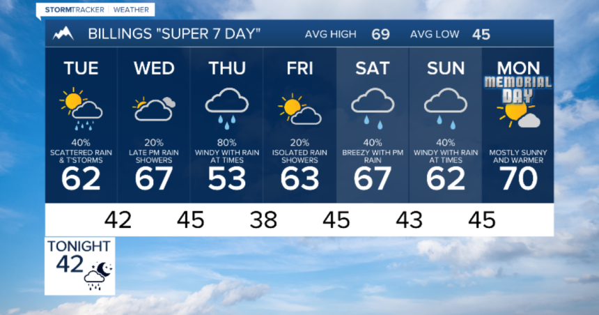
BILLINGS — This week leading up to the end of May will be full of activity and storms, with the first of three storms moving through Montana and Wyoming. Expect scattered showers, thunderstorms, and mountain snow on Monday night and Tuesday. Winter Storm Warnings and Winter Weather Advisories are in effect for the mountains until Tuesday afternoon, with the potential for over a foot of snow in the highest elevations.
By late Tuesday into early Wednesday, the first storm will move away, bringing a brief period of calm before the next storm approaches. Wednesday will see increasing clouds and more moderate temperatures, with another round of rain in the lower elevations and snow in the mountains on Wednesday night and Thursday. Lingering rain and snow showers will be possible through Friday morning.
Shortly after, on Friday, the weather will briefly calm down as the second storm exits the region to make way for a third low-pressure trough by the upcoming weekend, including Memorial Day. Expect more rain in the valleys, snow in the mountains, and gusty winds on Saturday and early Sunday. However, the weather is expected to settle and warm up by Memorial Day.


