BILLINGS — There is a chance for isolated severe thunderstorms Friday afternoon and evening over a widespread area. Then we quickly shift gears into wetter and cooler weather by early next week.
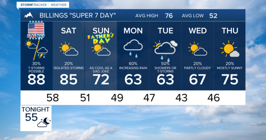
Ahead of our next weather system, temperatures by Friday afternoon will be mainly into the 80s, with low 90s possible anywhere from Billings to the east. For many locations, there will be the warmest days so far in 2024.
With the warmup comes an increased chance of showers and thunderstorms by Friday afternoon and evening. Storms will move off the mountains from east to west, producing the potential for damaging winds and quarter sized or larger hail.
Saturday remains very warm and a few isolated strong storms could develop once again.
Father’s Day on Sunday looks quiet with temperatures in the 60s and 70s and a mix of clouds and sun. A few showers and storms could develop by later in the day.
A surge of cold air moves into the Northern Rockies by Monday and Tuesday. This may produce snowfall over the higher elevations of the Beartooths, Absarokas and Crazy Mountains.
There are still plenty of fuzzy details with this weather system early next week. Potential impacts could include difficult Backcountry conditions and travel could be impacted in the high elevations.


