BILLINGS — The initial disturbance in a series is currently passing over Montana and Wyoming on Saturday afternoon and evening, resulting in several strong to severe thunderstorms. Fortunately, the most active weather will move out of the region to the east by midnight. However, we can expect gusty winds and cooler air moving in our direction.
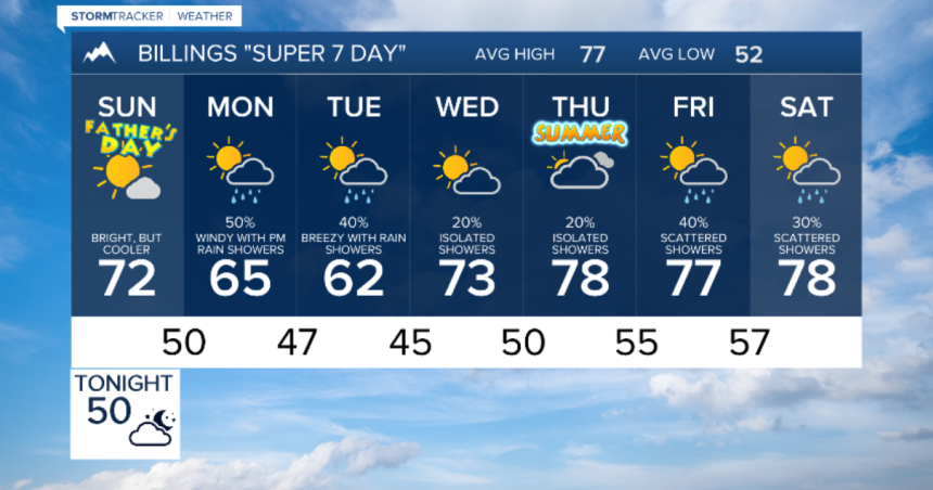
On Father’s Day Sunday, the northern Rockies will experience a brief respite from the active weather, with a mostly clear morning and increasing clouds later in the day. While there will still be moderate breezes, it won’t be as windy as Saturday. The next storm in the series is set to arrive on Monday, delaying the start of summer until Thursday afternoon.
Monday and Tuesday will see the second storm passing through our region, bringing rain at lower elevations, gusty winds, and snow primarily above 6500 feet. High temperatures will also drop well below normal. Wednesday will be calmer, though isolated showers remain possible. Another round of rain showers and thunderstorms is expected later in the week.


