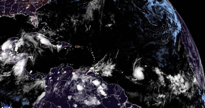
Beryl has now strengthened into a hurricane — after it formed over the Atlantic Ocean and moved towards the Caribbean Sea on Saturday — and was expected to form into a major category 3 storm from Saturday into Sunday and possibly enter the Gulf of Mexico after threatening the Windward Islands.
By 5 p.m. ET on Saturday Beryl had rapidly intensified into the first hurricane of the season with 75 mph winds (Cat 1).
Several Caribbean islands now appear to be under a hurricane warning making this the first of the season. Beryl is an early arrival for such storms this time of year.
By Saturday afternoon Beryl was about 800 miles east of Barbados, rapidly intensifying as it approached the Windward Islands by Sunday night into Monday with widespread damage expected.
The National Hurricane Center forecast a major hurricane (Cat 3) to come with winds in excess of 111 mph.
NHC said “Beryl is expected to be a dangerous major hurricane when it reaches the Windward Islands late Sunday night or Monday, bringing destructive hurricane-force winds and life-threatening storm surge. Hurricane Watch and Warnings are in effect for much of the Windward Islands.”
Weather
Hurricane watches issued as Tropical Storm Beryl continues to strengthen
9:10 PM, Jun 28, 2024
Where Beryl goes after it crosses the Windward Islands still remained to be seen by Saturday night, accordingto Scripps News Meteorologist Julie Martin.
By early Saturday Beryl had become a 65 mph storm, with a projected track to take it over southern areas of the Dominican Republic and Haiti and over Jamaica and parts of Cuba. By Tuesday the storm is expected to strengthen dramatically with winds of up to 115 mph at times possible, according to estimates.
3 to 6 inches of rain was expected and 2 to 4 feet of storm surge in areas was predicted.
It is expected to cross over some islands in the Caribbean Sea as a category 3 which would bring destructive life threatening storm surge, power outages, and damage.
There is also another system two days behind Beryl that could bring more problems for the islands.
It is very atypical to have a hurricane form in this part of Atlantic this time of year. The last time was in 1933.
There is also another disturbance in the Gulf of Mexico that is just expected to bring rain to coastal areas of Mexico.


