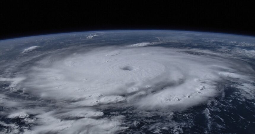
Hurricane Beryl swept through Jamaica overnight as a Category 4 storm, causing extensive damage by tearing off roofs and resulting in at least seven fatalities in the southeast Caribbean.
The National Hurricane Center has downgraded Beryl to a Category 3 storm, but it is projected to pass through the Cayman Islands early Thursday before heading towards Mexico’s Yucatan Peninsula. This will bring strong winds, widespread flooding, and dangerous storm surges. Storm surges of 2 to 4 feet above normal are expected in some areas of the Cayman Islands, while parts of the Yucatan could experience storm surges of 4 to 6 feet.
As of Wednesday night, Beryl maintained sustained winds of 130 mph, which is lower than its peak strength of 165 mph on Tuesday.
National Hurricane Center
“Strong winds, dangerous storm surge, damaging waves, and areas of flooding are expected to occur in the Cayman Islands today where a Hurricane Warning remains in effect,” stated the National Hurricane Center in a communication. “Hurricane-force winds, dangerous storm surge, and heavy rainfall are expected over portions of the Yucatan Peninsula and Belize beginning tonight as Beryl approaches that area as a hurricane.”
Authorities in Mexico have issued a hurricane warning for the coast from Puerto Costa Maya to Cancun in anticipation of the storm’s arrival. There is uncertainty regarding Beryl’s strength and trajectory in the coming days. While wind shear is likely to weaken the storm, there are differing opinions among computerized forecast models on the impact of wind shear.
Beryl, the first Atlantic hurricane of the season, has leveraged warm ocean waters to become the earliest Category 4 hurricane on record.


