BILLINGS — While California and much of the West Coast bakes under a strong ridge of high pressure, Montana and Wyoming continue to benefit on the east side of that ridge with a few small disturbances. These disturbances have brought and will bring scattered showers and thunderstorms, as well as comfortable highs, for the last several days and into this Saturday.
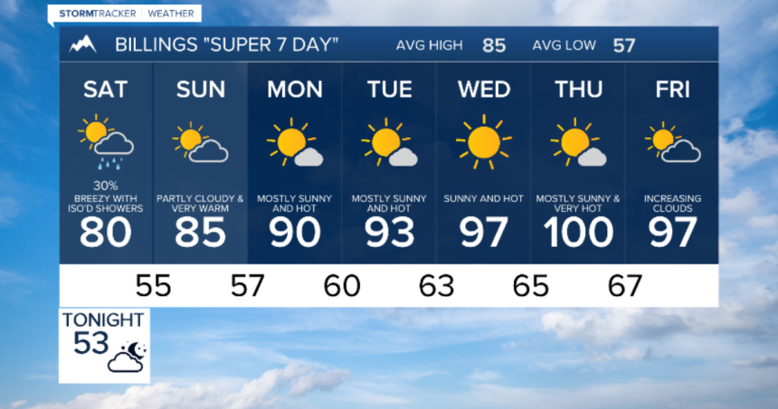
We can expect a quiet Saturday morning followed by one last round of scattered rain showers and thunderstorms Saturday afternoon and evening. It will be a breezy day with slightly cooler than average highs. Sunday will be partly cloudy and dry for almost everyone, with a minor warming trend. Much hotter weather is ahead.
That strong ridge over the West Coast will eventually start moving eastward over the Great Basin and then the Rockies. As we progress through next week, we can expect fewer clouds, less wind, and more heat. Thursday will be the hottest day for most of our area, likely the hottest we’ve been this year. Friday will be slightly cooler.


