Missoula County and the Lolo and Bitterroot national forests increased fire danger to “extreme,” the most severe of five levels, indicating a profound risk of large, intense and difficult-to-control wildfires from even the smallest fire starts.
And fire restrictions entirely prohibiting campfires and other activities go into effect Friday on the Bitterroot National Forest.
The Missoula County Fire Protection Association raised the level on Wednesday afternoon. The Lolo, which surrounds Missoula, Seeley Lake, Ovando and the lower Clark Fork River region, announced the increase after 6 p.m. Tuesday. The Bitterroot, which spans from around Lolo on the north to Lost Trail Pass at the Montana-Idaho border on the south, announced the change in status and forthcoming restrictions just before 1 p.m. Wednesday.
“‘Extreme’ is the highest fire danger level possible. When fire danger is ‘extreme,’ fires start quickly, spread furiously and burn intensely,” the Bitterroot National Forest stated Wednesday. “All fires are potentially serious and development into high-intensity burning will be faster and occur even on smaller fires. Direct attack — firefighters using direct methods to suppress a fire — is rarely possible and may be dangerous except immediately after ignition.”
People are also reading…
Both forests, in their respective announcements, attributed the increase in fire danger to hot, dry weather and fuel conditions. The Lolo stated that 32 of the 33 fires recorded across the forest so far this season were caused by humans; one was caused by lightning.
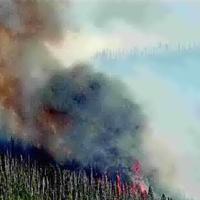
The Miller Peak fire burning west of Clinton and southeast of Missoula grew modestly Tuesday as it inched eastward toward Clinton.
The fire was up to 1,972 acres by early Wednesday morning, an increase of 212 acres over the past 24 hours. Its eastern front was about 5.5 miles from Clinton; down from about 6.24 the day before.
Maps of the fire perimeter published Tuesday and Wednesday mornings showed the fire had pushed over the divide between the Miller Creek and Clinton sides of the northern Sapphire Mountains. It was beginning to burn down the far upper reaches of Greenough and Moccasin creeks’ drainages, and toward Schwartz Creek’s west fork.
The fire’s southwestern edge was less than a mile from the valley floor and some homes and ranch… (truncated)


