BILLINGS — Montana is no stranger to big wind events.
For Billings residents, most remember the 2010 EF-2 tornado that damaged MetraPark.
However, straight-line winds have historically caused more damage in the state than tornadoes.
Kelsey Boggs, MTN News
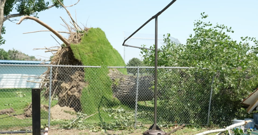
Wednesday night in Missoula left trees toppled, vehicles destroyed, and properties cluttered with debris.
But Miles City residents can also understand, despite the distance between them.
“In straight-line wind situations, all that damage is in one direction,” says Joe Lester, the chief meteorologist at the National Weather Service in Billings.
Lester has tracked many of the state’s most destructive storms, noting that they often occur during “thunderstorm season” when hot air rises, creating powerful wind gusts.
Wind gusts at the Missoula airport reached 81 mph, nearing the Billings all-time record of 85 mph in July 2007.
Although impressive, these speeds are not uncommon in places like Livingston or Great Falls, where wind speeds can reach the triple digits.
“Livingston had a peak gust of 92 mph earlier this year, second only to the record gust of 94 mph in December 1978,” said Lester.
“The winds in Great Falls and Livingston are known for being on a larger scale,” added Ed McIntosh, KTVQ’s Chief Meteorologist.
McIntosh emphasizes the difference between the recent localized storms in Missoula and Miles City compared to what is typically seen in mountainous regions.
With many more hot days ahead, these big wind events are likely to continue until cooler fall weather arrives.


