BILLINGS — The week starts off unsettled and then it’s all about how hot will it get by later in the week. But there are some signals we could get even cooler than average temperatures next week.
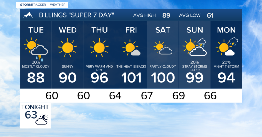
A few isolated storms have developed Monday evening, but our best chance of rain comes Tuesday. The amount of moisture is going up in the atmosphere and pockets of some heavier rain and isolated thunderstorms are possible Tuesday afternoon and evening.
Unfortunately, any of these storms For a Monday evening or Tuesday evening could come with some gusty winds of 30 to 40 mph. With the dry conditions and frequent lightning around storms, fire weather is a concern.
Temperatures will be in the 80s to low 90s on Tuesday and Wednesday for the afternoon highs. Wednesday trends much drier and then temperatures quickly climb starting Thursday.
The hottest days appear to be Thursday, Friday and Saturday, when readings will climb into the mid 90s to low triple digits. Overnight temperatures will be in the 50s and 60s, and conditions will stay generally dry except for isolated storms, especially closer to the mountains.
If the current pattern holds, we could be in for a treat next week as we’ll get some relief from the heat. Highs could back off to the 80s and possibly even 70s by around next Thursday or Friday.
Again, that’s a long way off, so we will update the forecast as we get closer.


