BILLINGS — Record highs have been experienced in Montana and Wyoming recently due to a ridge of high pressure, bringing with it haze and smoke from local and regional fires. Saturday was slightly cooler than Friday, signaling the start of a more favorable weather pattern for many over the next week.
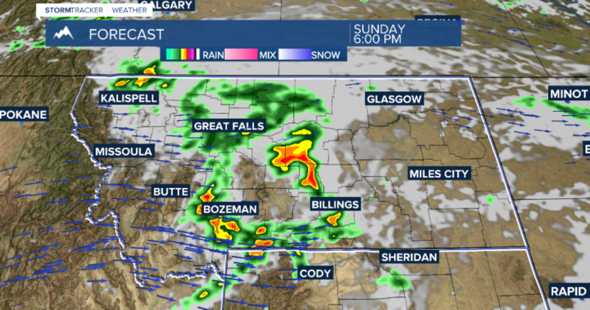
A disturbance is expected to move over Montana and Wyoming on Sunday, bringing a line of showers and thunderstorms in the late afternoon and early evening. While not everyone will see rain, the potential for PM Sunday thunderstorms is likely.
Monday will be less active but still breezy, hazy, and seasonably hot. Scattered showers and isolated thunderstorms are forecasted from next Tuesday through next Saturday, with the heaviest rain expected late Tuesday through late Thursday and lingering showers into late next week.


