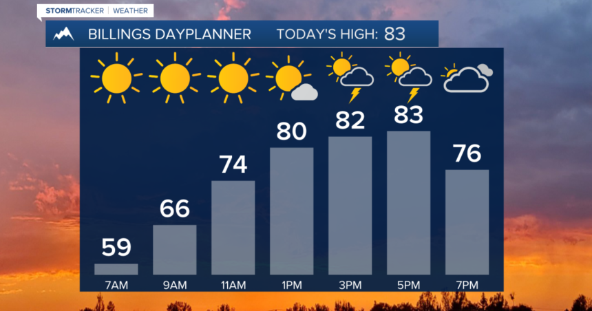
BILLINGS — We are currently experiencing a weak cold front, resulting in slightly cooler daytime temperatures on Wednesday with highs ranging from the upper 70s to mid 80s. There is a possibility of isolated showers and thunderstorms, particularly in eastern Montana where a few storms may become strong to severe, bringing concerns of gusty winds and heavy rain.
Thursday is expected to see mainly 80s for daytime highs as high pressure moves in, resulting in mostly dry conditions across the area with only sporadic showers.
Friday still holds a chance for showers and thunderstorms as temperatures climb into the upper 80s to near 90° during the day.
Over the weekend and into early next week, there remains a possibility of hit or miss showers and thunderstorms with highs ranging from the upper 80s to low 90s.
-Miller Robson
Q2 Morning Meteorologist
miller.robson@ktvq.com