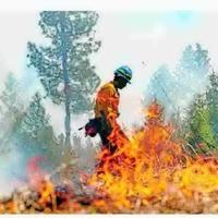
A prescribed burn near Ovando escaped containment recently, more than tripling in size to become the Nevada Lake fire. Though the fire was intended to cover only 65 acres, it now spans more than 200 acres on the border between Powell and Lewis and Clark counties.
According to InciWeb, a disaster management database managed by the Forest Service, “attempts to control ‘slopover’ or areas where the prescribed fire escaped containment lines were unsuccessful.” Montana Fish, Wildlife & Parks planned the burn with the Montana Department of Natural Resources and Conservation and Blackfoot Challenge, an Ovando-based community conservation group. While the fire grew substantially early in the week, it has not significantly changed in size since Wednesday.
Montana’s western forests, as well as its eastern plains, have been shaped by fire, purposeful and otherwise, over the course of millennia. Prescribed burns represent the human application of fire on terrain, using intentional combustion to clear excess ground fuel within a well-monitored perimeter. Prescribed fire differs from forest thinning, the process of clearing potential wildfire fuel from forests with machines or by hand.
People are also reading…
Prescribed burns often present a cheaper alternative to forest thinning, though intentional fire as a strategy has faced pushback since early colonists encountered Indigenous peoples using similar practices across North America. Prescribed burns didn’t enter the United States’ forest management toolbox until the latter half of the 20th century, when the Forest Service began utilizing fire to reduce the risk of large wildfires through the controlled combustion of excess fuels.
Robbie Magnan, director of the Fort Peck Tribes’ Fish and Wildlife Department, has seen the benefits of prescribed fire for sustainable agriculture, ecological health and fire protection.
“It’s a very good tool if it’s used right,” Magnan said.
The practice remains dependent on weather. Though prescribed burns are scheduled well in advance, federal and state agencies ignite the fire only when wind, heat and humidity conditions meet specific safety standards.
After two early-September rainstorms, land managing agencies planned prescribed fires around the state throughout the early fall. According to Anna Bateson, a public affairs specialist with Lolo National Forest, a hot, dry autumn has led to cancellations and postponements.
“This wildfire season has been a little bit longer than most of the average seasons,” Bateson said.
Not all prescribed burns were put off, though, and on Monday, the prescribed burn near Ovando escaped containment.
According to Chiara Cipriano, a public affairs officer with the Helena-Lewis and Clark National Forest, escaped prescribed fires, while not unheard of, are uncommon.
“99.84% of prescribed fires proceed as planned,” Cipriano wrote in an email to Montana Free Press.
“It’s always a concern. It’s always a risk you need to mitigate,” said Erik Peterson, a former wildland firefighter and fourth-generation Montana rancher near Miles City. Peterson has been conducting prescribed burns on his own land since the early 2000s and has yet to have a fire break containment.
After 15 years working as a wildland firefighter, Peterson also serves as a volunteer firefighter in Custer County, integrating his smaller-scale prescribed fire experience with countywide efforts to mitigate fire danger. He admits that ranchers are sometimes concerned about the process because “they value every blade of grass, and rightfully so.”
“But in the long run, it becomes beneficial because basically everything in the soil has adapted, over however many years, to fire,” Peterson said. “When you take fire out of the ecosystem, it does have negative impacts.”
Peterson emphasized that prescribed burn decisions are dependent not only on weather conditions during the burn, but also on season long trends.
“It’s all monitoring the ground. After the fire is done, how much rain have we had? What have the temperatures been? There’s nothing set in stone,” Peterson said. “It’s always adaptive to what the conditions have become afterward.”
Erin Line barger, the cofounder and chief executive of Robotics 88, a startup that produces drones for planning, mapping, monitoring and mopping up prescribed burns, introduces a new tool for employing and understanding the time tested practice.
Robotics 88’s drones conduct land surveys before a prescribed fire, collecting data for predicting fire behavior and establishing a baseline for post-burn assessments. During the prescribed fire, the drones provide real-time situational awareness by tracking fire parameters like rate of spread and personnel locations. After the fire, the drones repeat the land survey and compare it to the pre-fire data, ultimately generating a “fire report card,” a comprehensive analysis with a wide range of measurements including total acreage burned and overall changes in fuel volume.
In the context of the 2024 fire season, prolonged dry spells and high temperatures have limited the application of broadcast burns (prescribed fire spread across a landscape) in favor of pile burning (the combustion of forest debris that’s been organized into well-separated clumps). “A burn could be done anytime, but summer burns can be challenging to control and winter burns can be challenging to start,” Line barger said.


