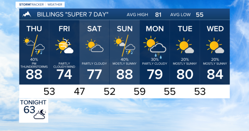
BILLINGS — Strong to severe thunderstorms are possible from mid-day Thursday into the evening hours. Primary threats are large hail and strong winds, but heavy rain and even an isolated tornado are possible.
An area of low pressure skims the northern border of Montana through the day on Thursday. This will push a cold front from West to east across the state triggering thunderstorms.
This cold front will be colliding with some very moist and warm air, especially into the eastern edge of Montana toward the Dakotas. Highs will warm into the 80s to low 90s ahead of the front.
Storms will develop west of Billings from the Livingston to Harlowton, Judith Gap areas relatively early. The best chance for storms around Billings will be in the early afternoon.
Storms are expected to increase in intensity as they move from West to east, bringing a chance of large hail, gusty winds up to 70 to 80 mph, and heavy rain into eastern Montana towards the Dakotas.
The biggest threats will be large hail and wind, but there is a tornado threat as well. Heavy rain could cause some localized flooding. But this storm system is pretty fast moving, decreasing the chance of lingering storms.
The weather system should be exiting Montana into the Dakotas during the afternoon and the evening. But the cold front will swing down some chillier air overnight, bringing temperatures to the 60s and 70s for the highs on Friday.
The thunderstorm risk will reduce on Friday, but still a few storms are possible in northeastern Montana. Along with the cooldown, expect breezy conditions with 15 to 25 mile per hour winds common on Friday.
Another weather system will bring another chance of showers and thunderstorms late Sunday.


