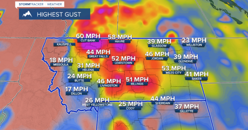
BILLINGS — A cold front brought strong wind and severe thunderstorms to Montana and Wyoming on Thursday, and another area low pressure moving over Montana brought additional wind and northern rain on Friday. After a few stormy days, we have quieter weather in the short term. We can expect fewer clouds and weaker wind tonight with more sun and warmth on Saturday.
Another trough of low pressure will sink over the northern tier of states beginning Sunday, and its first act will be to bring rain showers and thunderstorms late Sunday afternoon and evening. Temperatures will be warmer than average before the rain arrives, but we’ll fall below average again. We’ll have more rain on Monday/Tuesday before a brief break.
The “troughy” weather pattern will remain over Montana and Wyoming on Wednesday and Independence Day Thursday, and that will mean another round of light rain and isolated thunderstorms late Wednesday and Thursday. It doesn’t look to be heavy rain, but it may affect your outdoor holiday plans. We can expect fewer clouds by next Friday.


