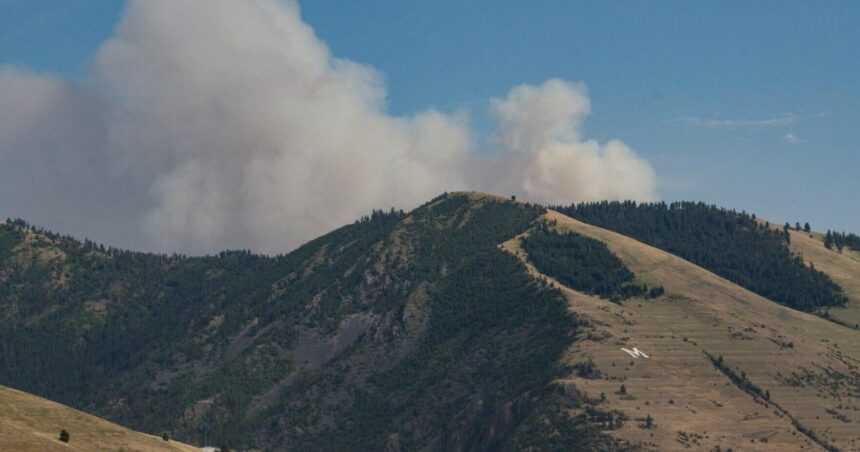
A wildfire ignited in upper Miller Creek south of Missoula and quickly grew to at least 500 acres on Sunday evening, sending a column of smoke up over the South Hills.
A smoke plume from the newly ignited Miller Peak fire southeast of Missoula rises over Mount Sentinel from the Miller Creek drainage on Sunday, July 14, 2024.

A wildfire ignited in upper Miller Creek south of Missoula and quickly grew to at least 150 acres on Sunday afternoon, sending a column of smoke up over the South Hills. (Photo courtesy of: Jason Scott)
The Miller Peak fire is burning about 10 miles southeast of downtown in the Plant Creek drainage, a tributary to Miller Creek. The fire’s initial reported location was just 3,900 feet east of a wildfire that broke out the previous Sunday, July 7, and burned about 5 acres before being fully contained.
According to interagency dispatch records, wildland firefighters were dispatched to the Miller Peak fire at 4:38 p.m. Sunday. The records listed the fire at an estimated 150 acres by 6 p.m., up from an initial 100 acres. The Lolo National Forest stated in a Facebook post that ground and aerial resources were responding to the fire.
People are also reading…
Online flight tracking records showed two large air tankers, each BAe-146 quad-jet aircraft that usually carry fire retardant, flying over the fire at 6 p.m. Two helicopters, a tanker lead plane and an air-attack supervisor plane were also on the fire.
This is a developing story and will be updated.
Joshua Murdock covers the outdoors and natural resources for the Missoulian


