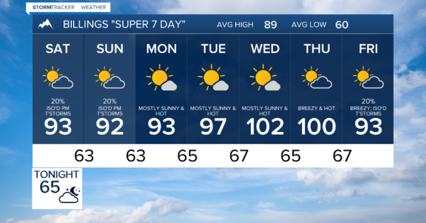
BILLINGS — The ridge of high pressure which has brought above-average heat and little to no beneficial range has yet to give up the ghost, and it’s still in control of our weather. After a few thunderstorms late this afternoon, we can expect decreasing clouds tonight and Saturday morning with mild lows and continued smoky air, too.
High pressure will keep Montana and Wyoming a handful of degrees hotter than average both Saturday and Sunday. Isolated to scattered showers and thunderstorms will bubble up both afternoons, but they’re more likely Saturday than Sunday, and many areas may end up completely dry… if you have outdoor plans, keep an eye to the sky!
The higher terrain of mainly western and central Montana and Wyoming will have the best chance for showers and thunderstorms the first half of next week, and eastern areas will likely stay dry and hot. After very hot days Wednesday and Thursday, a trough of low pressure will approach, we’ll get stronger breezes and modest cooling by next Friday.


