BILLINGS — The tail end of a small trough of low pressure brought showers, isolated thunderstorms, and gusty wind to northeast Montana on Friday, but it’s on its way out of the region. We can expect a mostly clear sky over Montana and Wyoming as we end May and begin June overnight. Despite the fairly clear sky, overnight lows will be milder than Friday for most areas.
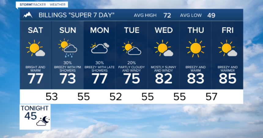
A small ridge of high pressure will bring more sunshine and warmth on Saturday as we start the new month of June. Highs will be 5-10 degrees warmer than average. Another trough of low pressure will bring more clouds on Sunday with afternoon and evening showers and isolated thunderstorms. Sunday will also be cooler with a stronger breeze developing in many areas.
Another trough of low pressure along with the jet stream will sink toward the northern Rockies in the first half of next week. Expect more clouds, a stronger breeze, and showers returning late Monday. The wind will be stronger on Tuesday and Wednesday, but we will also dry out. Another ridge will bring more warmth by late next week, with highs in the 80s in many areas.


