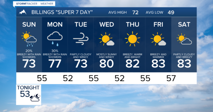
BILLINGS — Montana and Wyoming will experience the impact of two troughs of low pressure in the near and long term, leading to more unsettled weather. Tonight, we can anticipate increased cloud cover with isolated showers and thunderstorms. The same pattern will continue on Sunday with a few chances for more precipitation, although it is not expected to rain all day.
On Monday, we will see clouds increasing throughout the day as a second, stronger trough of low pressure approaches for the first half of next week. Rainfall is expected to move across both states from Monday afternoon to early Tuesday, giving most areas a chance of wet weather. However, it will not be a persistent event for anyone in our region.
As the second trough and the jet stream move over the northern Rockies from late Monday to Wednesday, stronger winds are expected for most locations. A High Wind Watch has been issued for north central and central Montana from late Monday to Wednesday, with gusts exceeding 65 mph possible. Towards the end of next week, we can look forward to more sunshine and warmth with lighter winds.


