The National Weather Service has issued a flood advisory for south-central Montana after a half-an-inch to an inch of rain fell in the Beartooth Mountains Sunday night and into Monday.
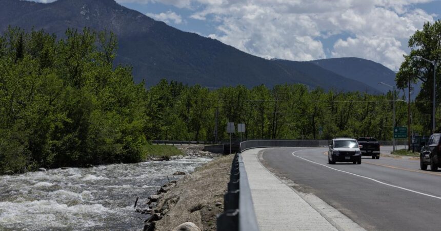
Rock Creek flows along South Broadway Avenue in Red Lodge on Saturday.
“Much of this fell on a ripe snowpack above 8,500 feet, likely enhancing snowmelt and intensifying runoff into small creeks and streams emanating from the mountains,” the Weather Service posted on its website.
“It may take 12 to 24 hours for this runoff to work out of the mountains into more populated foothills locations,” the advisory continued. “With streams already running high this additional runoff may push these streams out of their banks. Probability of minor flooding of small creeks and streams in the advisory area is 70%.”
The advisory applies to southwestern Carbon, southern Park, southwestern Stillwater and southwestern Sweet Grass counties.
People are also reading…
Areas that may see flooding include: Red Lodge, Bearcreek, Chico Hot Springs, Nye, McLeod, Mystic Lake, Dean, Alpine, Pine Creek, Jardine, Chico, Emigrant, Roscoe, Fishtail, Luther, Corwin Springs, Fox and Washoe.
With less rainfall in the Crazy Mountains, a flood advisory for that area has been lifted.
The Stillwater River continued its climb toward flood stage on Monday, inundating access roads, a boat ramp, parking and camping areas at the Whitebird fishing access site between Columbus and Absarokee, prompting a partial closure.
Snowmelt from the Beartooth Mountains has pushed the river up to 7,300 cubic feet per second. Normally around this time of year the flow is half as much. The maximum flow recorded on the river for June 10 was 7,810 cfs set in 1957.
Flood stage on the river is 7.5 feet. As of Monday, the Stillwater had climbed to almost 7 feet and temperatures for the rest of the week are expected to hit 80 degrees or warmer.
“Snowmelt will continue to keep waterways running high through the week,” the Weather Service warned.
Montana Fish, Wildlife & Parks has prohibited vehicle access to Whitebird FAS. Walk-in access is still allowed, but visitors must ensure they do not obstruct roadways, gates or other access points when parking. Visitors are encouraged to use caution at river sites this time of year, as conditions and water levels can change quickly.
Whitebird FAS will reopen to vehicle access as soon as conditions allow and any necessary maintenance work following the flooding is completed.
The high water warnings come as many residents of the region are still recovering from damage incurred during the June 2022 floods from a similar rain on snow event.
Rock Creek, which flows through Red Lodge, was flowing at a rate of 1,180 cfs, compared to the usual 474 cfs for this date. The runoff broke the record set for the date, 990 cfs established in 2018.
The peak height of Rock Creek was set on June 13, 2022, at 7.98 feet. As of Monday morning, the height had dropped to about 7.25 feet.
The Boulder River at Big Timber was running at 5,880 cfs and climbing, compared to the median of 2,819 cfs for June 10.
The Clarks Fork Yellowstone River seemed to have leveled off at a flow of around 7,650 cfs, and was about a foot below flood stage.
The Yellowstone River at Billings was measured at 36,800 cfs on Monday, 12,400 cfs above normal for this date.


